01
Too many disconnected files
Photos, maps, CAD exports and downloads often end up spread across emails, shared drives and reporting packs.
Vista Metrics supports large infrastructure, energy and housebuilding projects with high-resolution drone mapping, interactive 3D models, aerial progress imagery and technical survey outputs — all packaged into a clean browser-based viewer for project managers, commercial teams and stakeholders.
Construction teams are already busy. The value of drone data is not just the capture — it is whether the project team can actually open it, understand it and use it without specialist software or another heavy folder of files.
Photos, maps, CAD exports and downloads often end up spread across emails, shared drives and reporting packs.
Directors, clients and consultants may need to understand progress without visiting site or opening technical software.
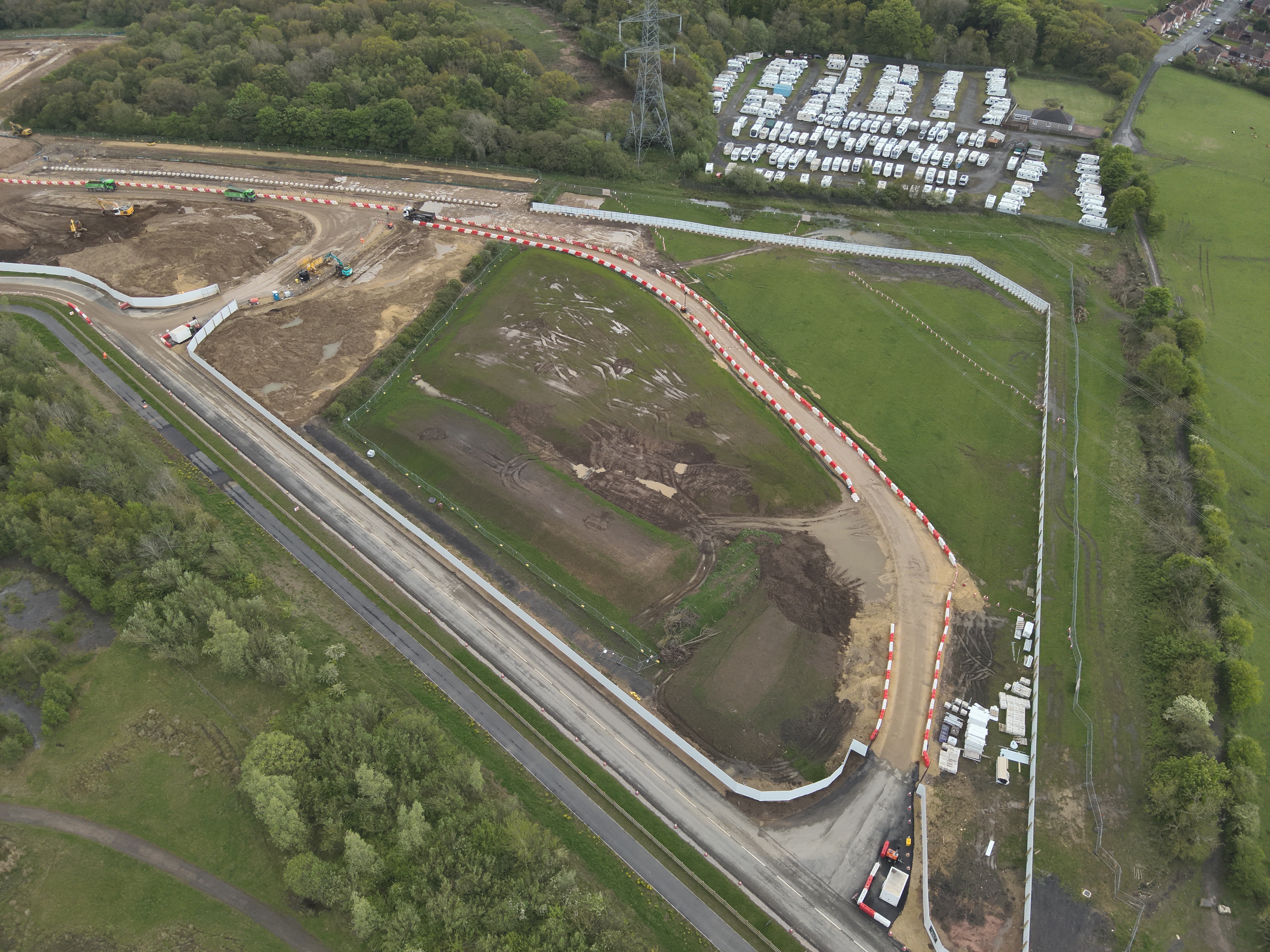
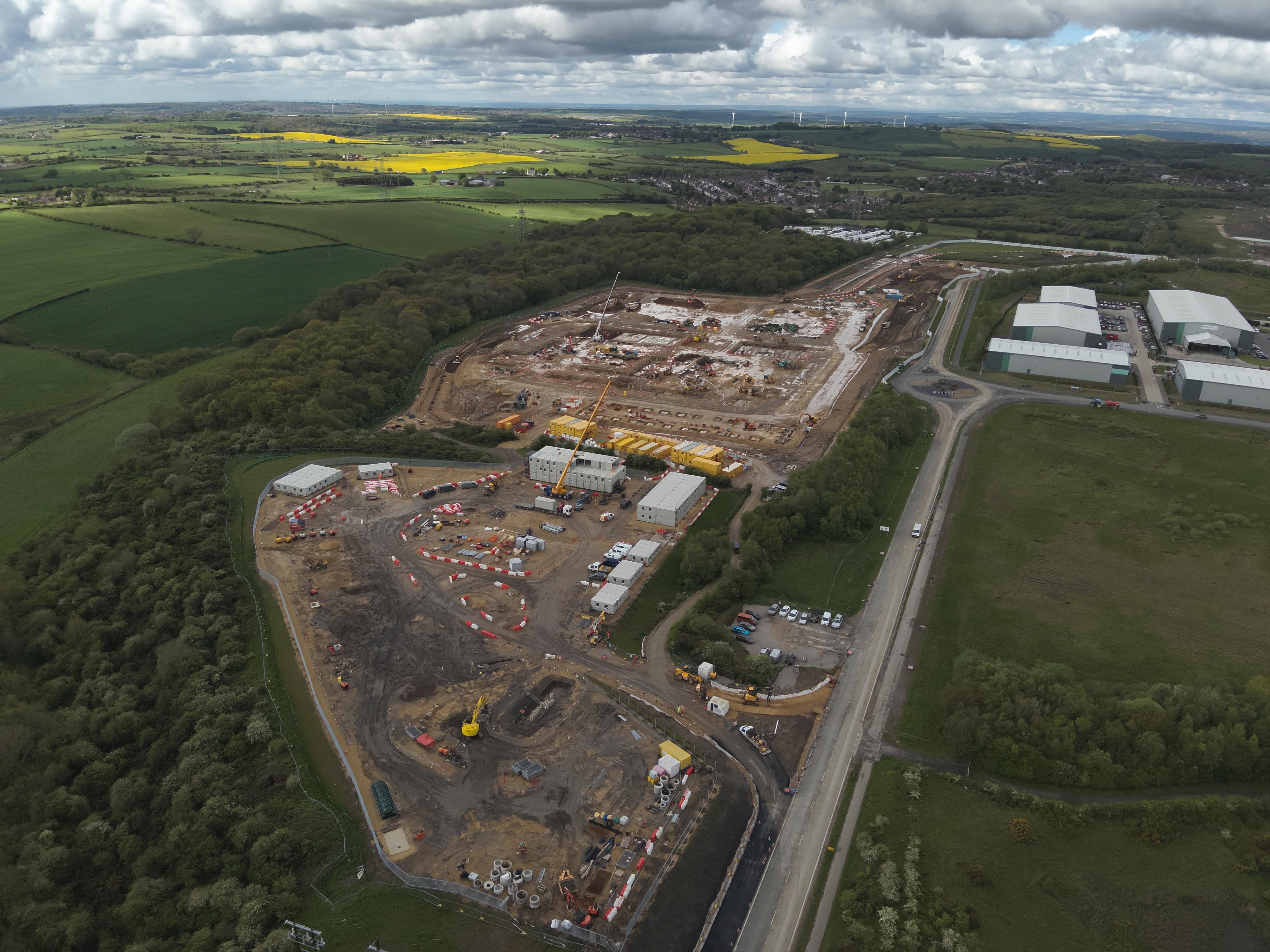
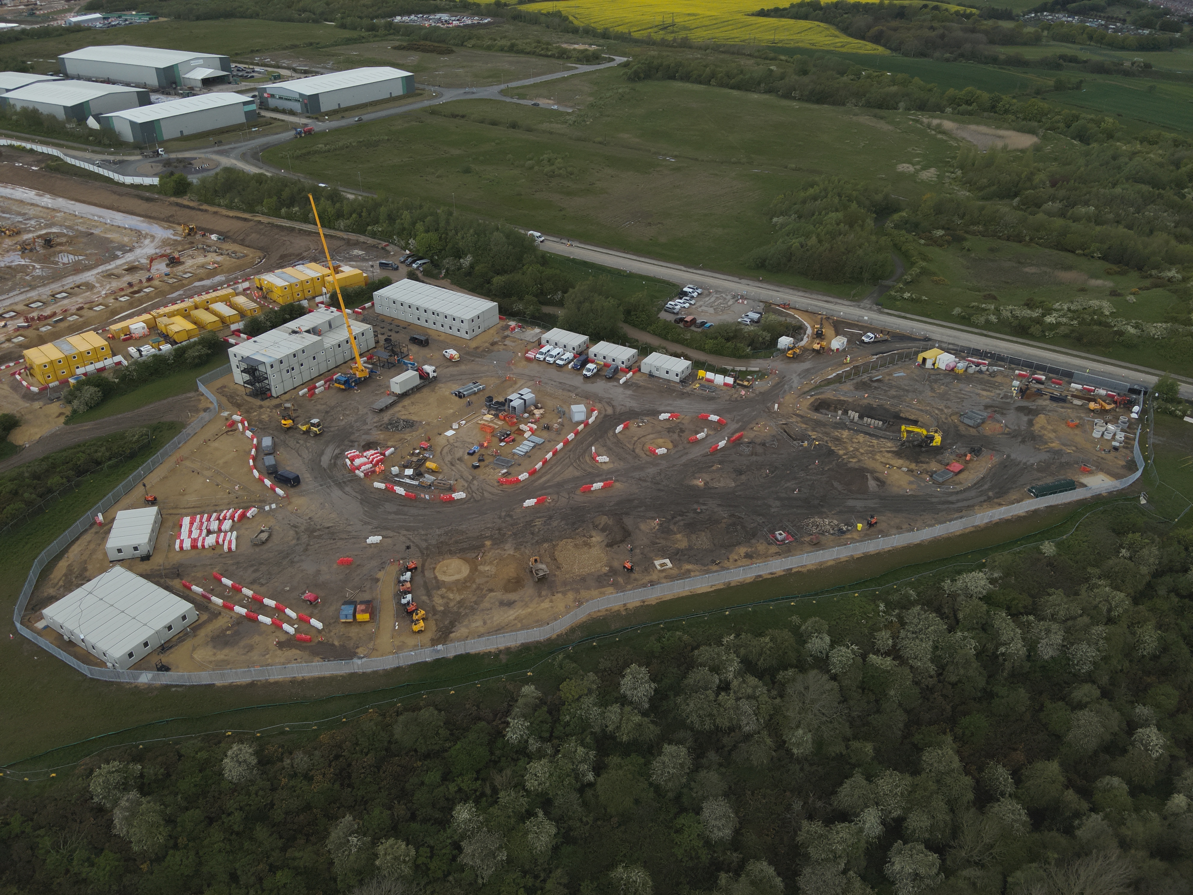
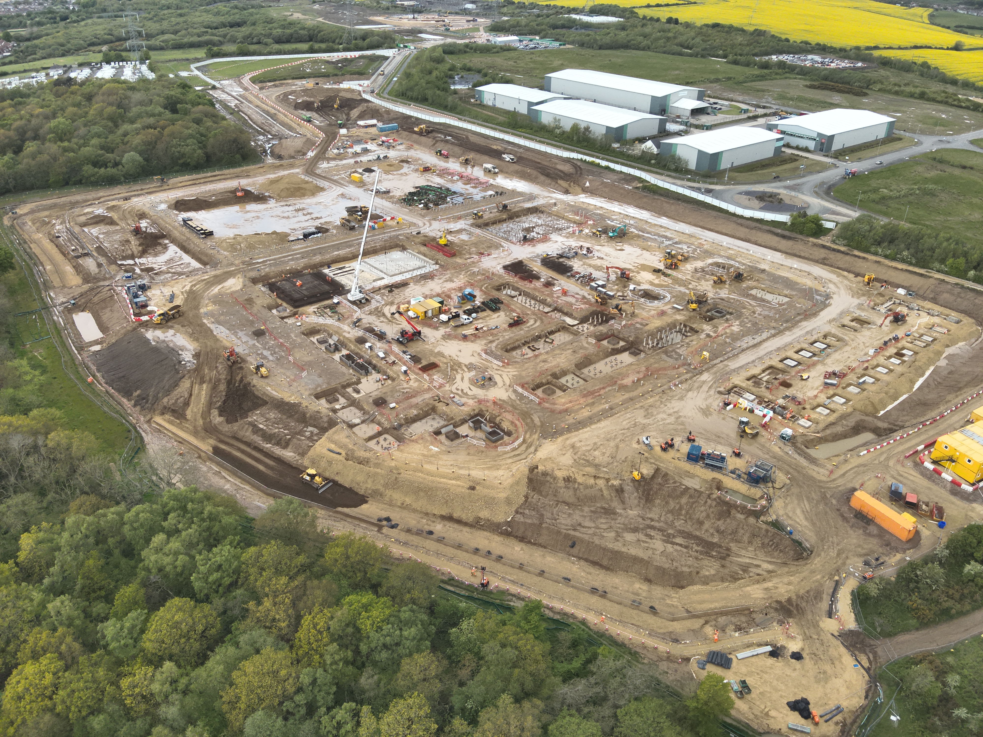
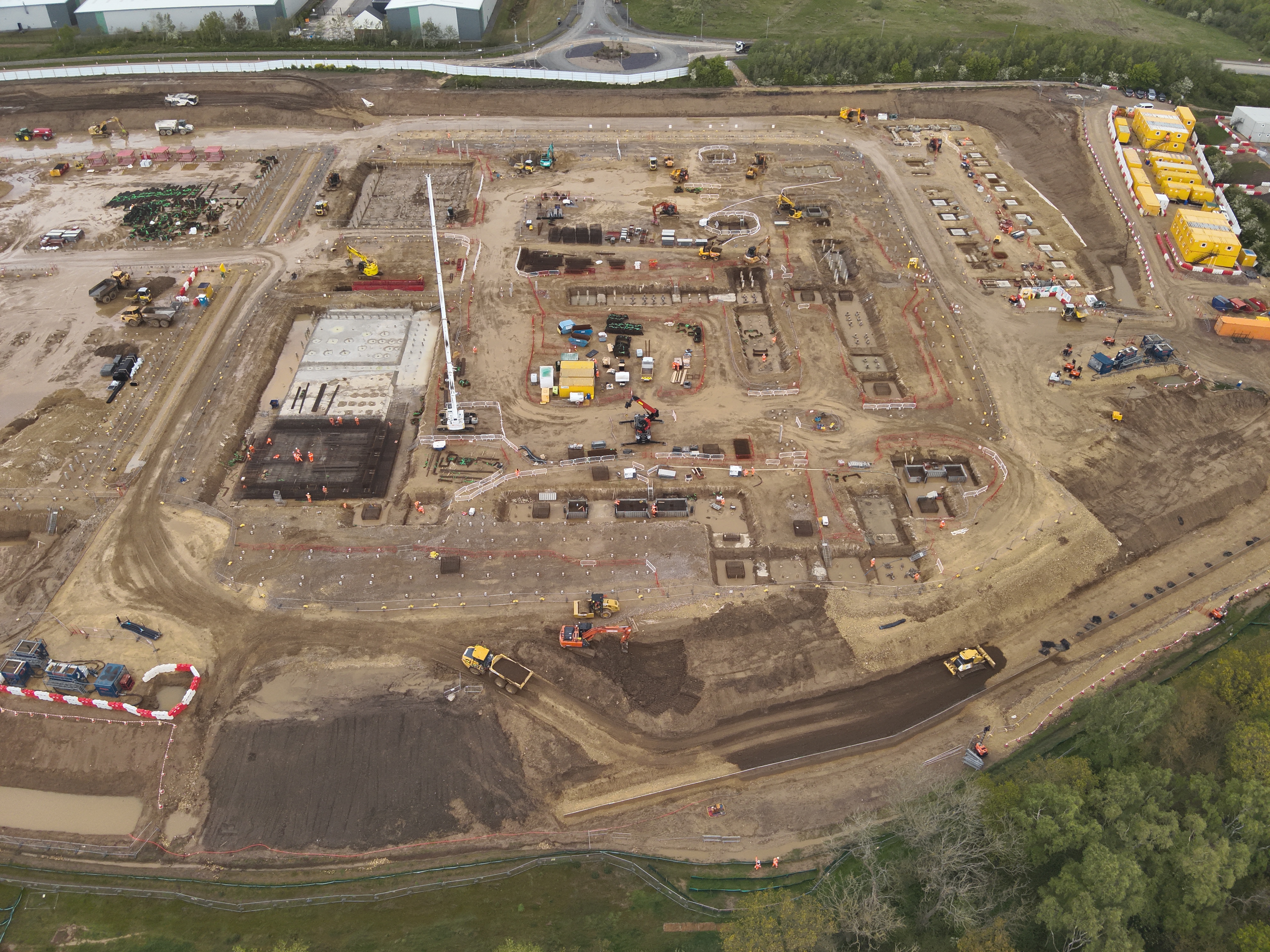
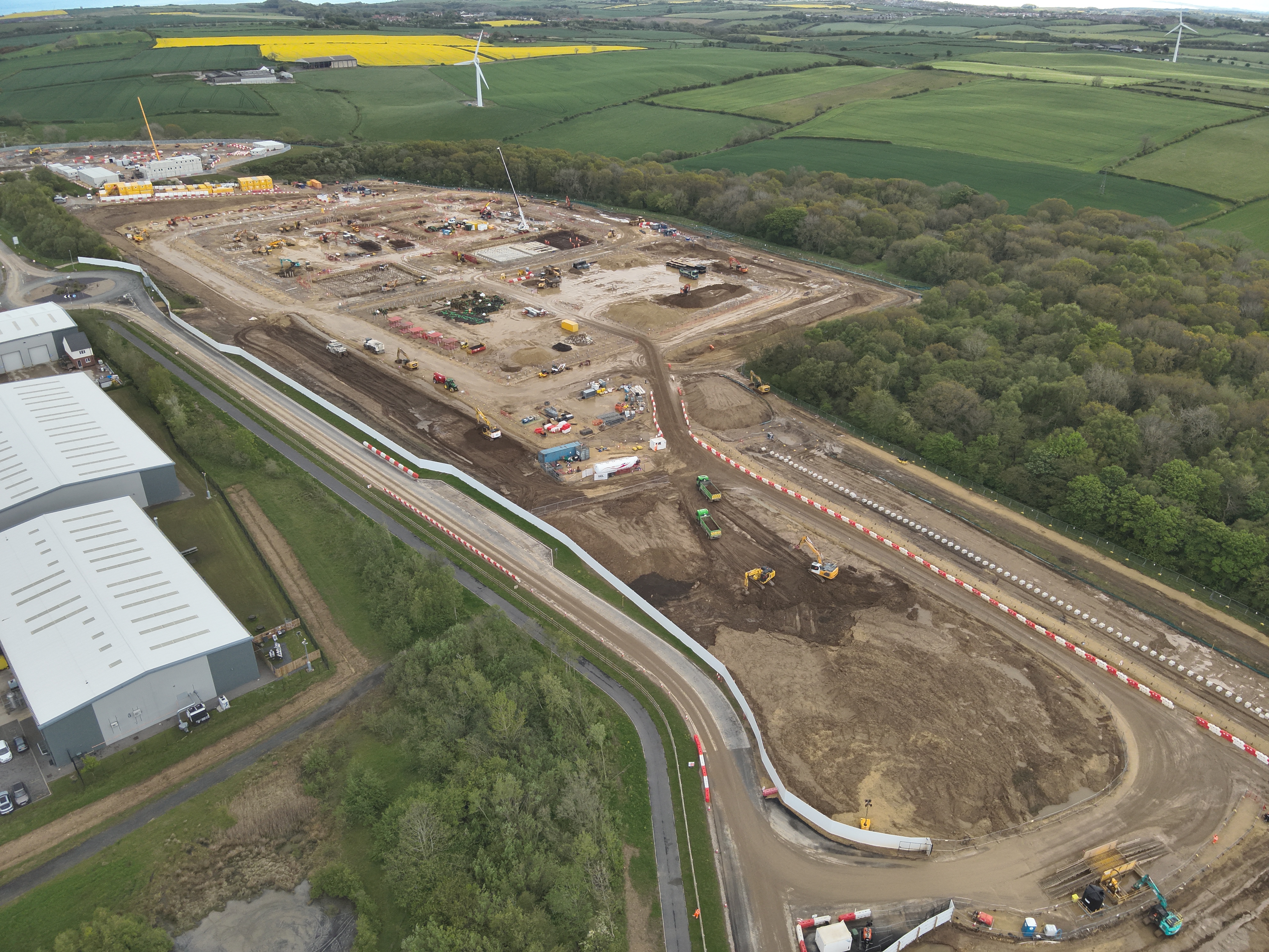
Ground-level images are useful, but they rarely show overall work fronts, access routes, stockpiles and site logistics together.
Repeatable visual records help reduce ambiguity when briefing teams, reviewing programme progress or discussing change.
3D models help project teams explain site conditions without relying on isolated photos or heavy technical files. They are useful for progress meetings, remote stakeholder updates, logistics discussions and showing what is happening on site to people who are not physically there.
The orthomosaic provides a current, map-style view of the full site. The DSM adds surface and height context, helping teams understand earthworks, stockpiles, access routes, drainage, working areas and site change.
 Orthomosaic
DSM / Surface Model
Orthomosaic
DSM / Surface Model
Repeated drone captures can create month-by-month visual records. This helps project managers evidence progress, brief stakeholders, review access and logistics, and reduce uncertainty around what has changed on site.
 Current Site View
Surface Context
Current Site View
Surface Context
The same browser-based structure works across different project types: live infrastructure and energy sites, housebuilding schemes, access routes, compounds, development land and large sites with multiple stakeholders.
Large sites often involve multiple work fronts, remote stakeholders, complex logistics and ongoing reporting pressure. A browser viewer gives the project team one clean reference point.
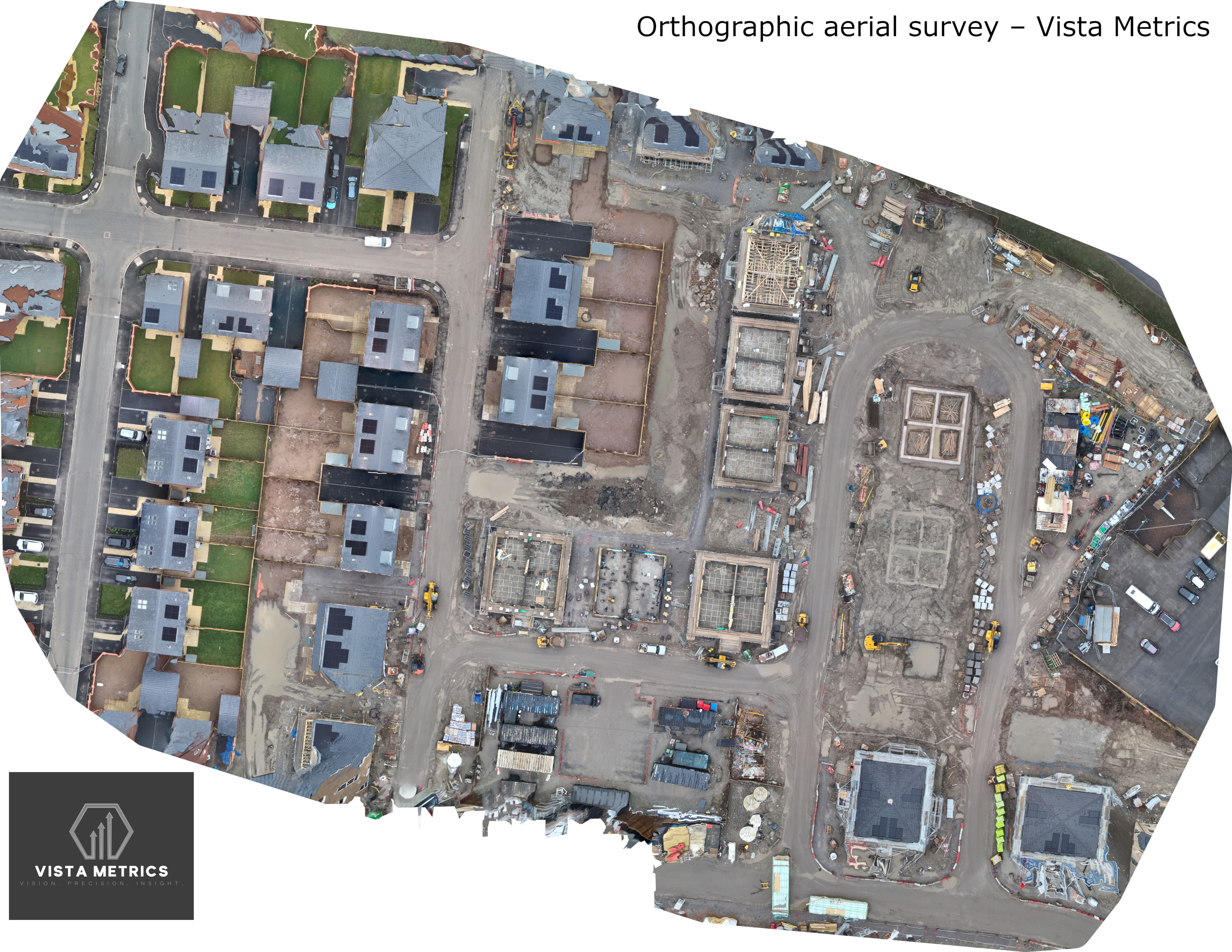
Useful for showing plot progress, roads, access, materials, partially built homes and wider development context without relying on ground photos alone.
Drone progress packs support coordination, stakeholder updates, site orientation, access planning, commercial conversations and internal reporting.
A curated image gallery gives teams quick, usable progress visuals without searching through raw drone folders. Images can support reporting, coordination, planning conversations and client-facing updates.
The browser viewer provides quick access for non-specialists, while downloadable survey outputs can be included for design, commercial, planning, site and technical teams. Outputs can be tailored to the project requirement and coordinate workflow.
Interactive model for quick visual understanding, stakeholder briefings and site context.
Download GLB3D model showing housebuilding progress, partially built homes and wider development context.
Download GLBUseful for opening site mapping layers in Google Earth-style workflows.
Download KMZHigh-resolution map-style site view for progress review, records and reporting.
Download PNGDSM imagery helps visualise terrain, stockpiles, level change and earthworks context.
Download JPGCurated aerial images for reporting, stakeholder updates, meetings and site records.
Download ExampleThe aim is to keep the process simple for the project team: agree the outputs, capture the site, process the data, and deliver everything through a clean browser viewer.
Agree site boundary, access, airspace, safety requirements, output needs and any coordinate workflow considerations.
Drone capture is planned to create consistent monthly outputs suitable for progress comparison and reporting.
Orthomosaic, DSM, 3D model, aerial imagery and optional technical deliverables are prepared.
The project team receives a clean browser viewer with headline visuals and relevant downloadable files.
Send over the site location, approximate boundary and the type of project. I’ll confirm what can be captured, what outputs are suitable, and how a monthly progress monitoring pack could be structured.